Hiking tour

Fluchtwand über Valdigastei

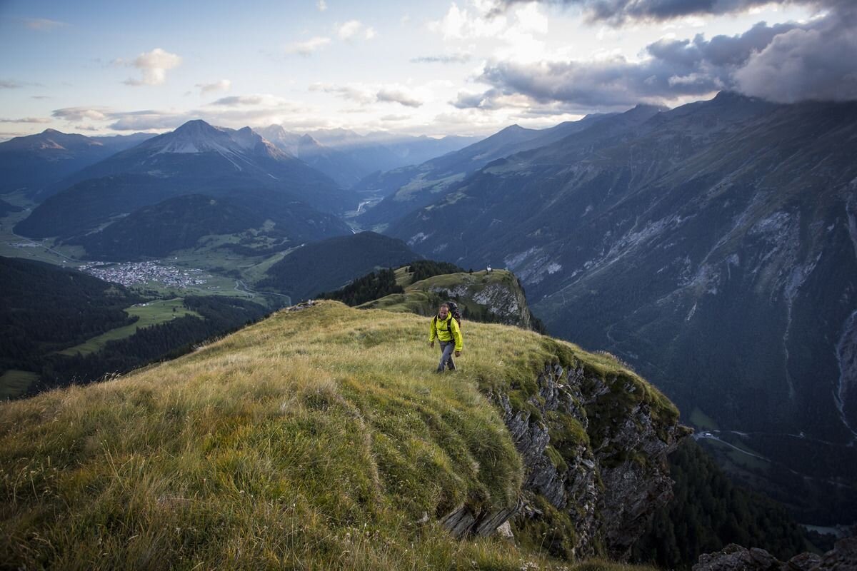
Trail no. 14 leads from the parish church in Nauders to the Parditschhof snack station. The ascent (No. 16) to the Bazahler Kopf begins at a height of 2,160 metres. From the crossroads, follow the old alpine path to the left towards Labaun and into the Valdigastei. Through the forest, continue on Trail no.16 to the Bazahler peaks (2,160 m). The Fluchtwand is already visible to the east on the steep, red Hiking trail no. 15a to the summit cross. The Fluchtwand inspires with unique views of three countries and mighty mountain ranges. The way back is via Trail no. 
tour2
7:0h
1024m
14.6km
Highest point
2350m
Start point
Nauders Dorf
End point
Fluchtwand

Similar Tours

Medium
458m | 4.43h | 10.43km
Hiking tour
Anton Renk-Hütte | Rundwanderung
Begin: Parkplatz Seilbahn Talstation | Ried im Oberinntal
End: Parkplatz Seilbahn Talstation | Ried im Oberinntal
Medium
593m | 4.5h | 9.2km
Hiking tour
Kaiserschützenweg - fortress variant
Begin: Festung Nauders
End: Nauders
Difficult
1692m | 13.6km
Hiking tour
Über das Wallfahrtsjöchl vom Kaunertal ins Pitztal
Begin: Parkplatz Wallfahrtskirche Kaltenbrunn
End: Eggenstall (St. Leonhard-Pitztal)
Difficult
1302m | 9h | 18.5km
Hiking tour
Aachner Höhenweg
Begin: Anton Renk Hütte
End: Gepatschhaus
Easy
368m | 4.5h | 8.3km
Hiking tour
Schwarzer and Grüner See
Begin: Bergstation Mutzkopf
End: Talstation Mutzkopf
Difficult
700m | 4km
Hiking tour
Ganderbildspitze, 2.863 m
Begin: Bergstation Bergkastel
Easy
226m | 2.5h | 6.4km
Hiking tour
Über den kleinen Mutzkopf retour nach Nauders
Begin: Bergstation Mutzkopf
End: Talstation Mutzkopf
Medium
588m | 4.92h | 13.5km
Hiking tour
Frudiger | Circular Hike
Begin: Parking area Tscheylücke | Pfunds
End: Parking area Tscheylücke | Pfunds