Walkway

Prutz via Römerweg trail

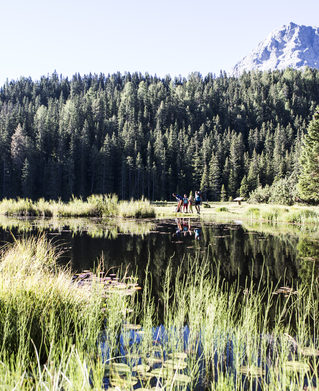
Starting point: Schlossweiher pond (grid square F4)
Character: only downhill, partly in the forest
Walking time: 1 hour

Description: Go towards Obladis, but immediately after the first house go right onto the Hohlweg trail down to the tennis court. At the crossing which comes soon after, either go right on the trail to the Felsenburg, which becomes quite flat, and then down to the left on the asphalted road to the Innbrücke bridge or go straight ahead to the vehicle road to the Asterhöfe.

Roundabout trails:
From Ladis on the Römerweg (ancient Roman trail) no. 31 towards Prutz, as described. At the crossing below the Panzer, go right to the Felsenburg, where trail no. 30 crosses. Keep right. At the last houses, the forest trail
up to Hallagras begins and follow it. Return to Ladis on the street. Walking time approx. 1 3/4 hours.
1:0h
12m
1.71km
Highest point
1191m
Start point
Schlossweiher pond
End point
Prutz

Similar Tours

Walkway
Ried - Herrensteig - Aussichtspunkt "Belvedere" - Ried
For further information
249m | 4.3km
Begin: östlicher Ostrand Ried
End: Ried
Walkway
Zur Labaunalm
For further information
739m | 3.5h | 9.7km
Begin: Pfarrkirche St. Valentin
End: Pfarrkirche St. Valentin
Walkway
Grasse (Kaunertal)
For further information
108m | 5km
Begin: Feichten
End: Feichten
Walkway
Sauregg (Fendels)
For further information
125m | 4km
Begin: Fendels
End: Fendels
Walkway
Kauner Wiesen
For further information
38m | 2km
Begin: Kauns
End: Kauns
Hiking
Sternenweg im Gepatsch
For further information
202m | 1.5h | 3620km
Begin: Stauwurzel Gepatschstausee
End: Gepatschhaus
Walkway
Tösens - Untertösens - St. Georgen
For further information
196m | 1.1km
Begin: Tösens
End: Untertösens
Walkway
Old way to the Riatschhof
For further information
245m | 3.5km
Begin: Nauders Mühle
End: Gasthof Martha